 Navigation
Mini-Map
A mini-map will appear in the top corner of your screen. By default, it will display:
- Your coordinates.
- Time of day.
- Season and Date.
- Waypoints.
- Entities.
You can configure mini-map settings with key.gui.xaero_open_settings.
Full Map
A full map can be viewed by pressing key.gui.xaero_open_map.
TIP: You can make seperate waypoint sets in the waypoint manager screen to organize waypoints. Waypoints can be made while playing by pressing key.gui.xaero_new_waypoint. Chunk claims can also be viewed in the map. Chunk claims are useful in multiplayer and allow you to force load regions. Chunks can be claimed in the claims' manager in the top-left of your inventory.
Navigation
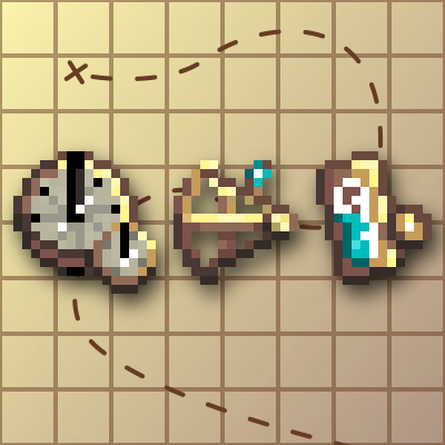
Navigating the world is not an easy task. In order to build a successful civilization, you must have a good grasp of your location, and a good record of important places! If you wish to avoid using the map or minimap and want a more immersive method for navigating the world you can craft precise instruments to determine your position.
Longitude
To find your Longitude, that is, your distance from the Prime Meridian, you need a clock! Specifically, you need a precise timepiece that keeps itself synchronized with the solar time at the Prime Meridian.
Smith an Unfinished Navigator's Timepiece before filling it with its internal mechanism.
Timepiece
航海士の時辰儀を製作したら、それを手に持ち、Right Click を押すことで、経度を確認できます。経度は東経または西経の度数で表され、本初子午線が0度、同じ気候帯では360度となることに注意してください。
Latitude
To find your Latitude, that is, your distance from the Equator, you need to determine the degrees at which you view either Polaris, the North Star, or the Sun. Specifically, you need a precise mechanism for viewing astronomical features and measuring their angular distance from the horizon.
Smith an Unfinished Sextant and then complete it in a workbench.
Sextant
六分儀を製作したら、それを手に持ち、Right Click を押すことで、緯度を測定できます。緯度は北または南の度数で表されることに注意してください。つまり、赤道が0度、極域が北または南の90度となります。
Altitude
To find your Altitude, that is, your vertical distance from the Sea Level datum, you need to measure atmospheric pressure. Specifically, you need a device containing a compressible fluid, and you need to measure the volume of that fluid to determine the pressure.
Smith an Unfinished Barometer and then complete it in a workbench.
Barometer
気圧計を作成したら、それを手に持ち、Right Click を押すことで、高度を確認できます。高度は海面基準からの距離で測定されることに注意してください。
脚注
Because you will be measuring distance in Degrees, it might be helpful to know the block conversions. Every 90 Degrees is 20,000 blocks, and every single degree is about 222 blocks.
In TerraFirmaGreg, Compasses will always point North.
Comments